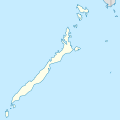
Berkas:Philippines location map (Palawan).svg

Ukuran pratayang PNG ini dari berkas SVG ini: 377 x 377 piksel Resolusi tanö bö'ö: 240 x 240 piksel | 480 x 480 piksel | 768 x 768 piksel | 1.024 x 1.024 piksel | 2.048 x 2.048 piksel.
Berkas si föföna sibai (Berkas SVG, 377 x 377 piksel, fa'ebua berkas: 3,65 MB)
Waö-waö berkas
Höndrögö ba mbaŵa/ginötö wamaigi hewisa berkas ba ginötö andrö
| Baŵa/Inötö | Khala-khala berkas | Su'a-su'a | Sangoguna'ö | Komentar | |
|---|---|---|---|---|---|
| fondrege bohou | 3 Mei 2021 12.35 |  | 377 × 377 (3,65 MB) | Petriolo | updated with NAMRIA borders |
| 27 Oktober 2017 00.23 |  | 377 × 377 (2,22 MB) | Mliu92 | User created page with UploadWizard |
Fangoguna'ö berkas
Lö nga'örö sangoguna'ö berkas andre
Fangoguna'ö berkas global
Wiki tanö bö'ö sangoguna'ö berkas andre
- Fangoguna'ö ba bcl.wikipedia.org
- Fangoguna'ö ba en.wikipedia.org
- Fangoguna'ö ba fr.wikipedia.org
- Fangoguna'ö ba id.wikipedia.org
- Fangoguna'ö ba ilo.wikipedia.org
- Fangoguna'ö ba lv.wikipedia.org
- Fangoguna'ö ba ml.wikipedia.org
- Fangoguna'ö ba si.wikipedia.org
- Fangoguna'ö ba uz.wikipedia.org

