
Berkas:Fiji location map.svg

Ukuran pratayang PNG ini dari berkas SVG ini: 467 x 599 piksel Resolusi tanö bö'ö: 187 x 240 piksel | 374 x 480 piksel | 599 x 768 piksel | 798 x 1.024 piksel | 1.596 x 2.048 piksel | 728 x 934 piksel.
Berkas si föföna sibai (Berkas SVG, 728 x 934 piksel, fa'ebua berkas: 144 KB)
Furugönia
| Fanutunö |
Deutsch: Positionskarte von Fidschi
Quadratische Plattkarte, N-S-Streckung 104 %. Geographische Begrenzung der Karte:
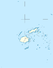
English: Location map of Fiji
Equirectangular projection, N/S stretching 104 %. Geographic limits of the map:
|
| Baŵa | |
| Kode |
Nifazökhigu samösa, using
|
| Sanura | NordNordWest |
| Fanehegö (Oguna'ö mangawuli berkas andre) |
Saya, pemilik hak cipta dari karya ini, dengan ini menerbitkan berkas ini di bawah ketentuan berikut: Berkas andre so barö lisensi Creative Commons Atribusi-BerbagiSerupa 3.0 Si lö mubulö'ö
|
| Versi lainnya |
Derivative works of this file: |


|
This map has been made or improved in the German Kartenwerkstatt (Map Lab). You can propose maps to improve as well.
|
Waö-waö berkas
Höndrögö ba mbaŵa/ginötö wamaigi hewisa berkas ba ginötö andrö
| Baŵa/Inötö | Khala-khala berkas | Su'a-su'a | Sangoguna'ö | Komentar | |
|---|---|---|---|---|---|
| fondrege bohou | 19 September 2011 17.19 | | 728 × 934 (144 KB) | NordNordWest | corr |
| 11 Oktober 2009 23.04 |  | 728 × 934 (218 KB) | NordNordWest | {{int:filedesc}} {{Information |Description= {{de|Positionskarte von Fidschi}} Quadratische Plattkarte, N-S-Streckung 104 %. Geographische Begrenzung der Karte: * N: 12.3° S * S: 21.8° S * W: 174.4° O * O: 177.9° W {{en|Location map of |
Fangoguna'ö berkas
Lö nga'örö sangoguna'ö berkas andre
Fangoguna'ö berkas global
Wiki tanö bö'ö sangoguna'ö berkas andre
- Fangoguna'ö ba af.wikipedia.org
- Fangoguna'ö ba an.wikipedia.org
- Fangoguna'ö ba ar.wikipedia.org
- Fangoguna'ö ba arz.wikipedia.org
- Fangoguna'ö ba ast.wikipedia.org
- Fangoguna'ö ba azb.wikipedia.org
- Fangoguna'ö ba az.wikipedia.org
- Fangoguna'ö ba ba.wikipedia.org
- Fangoguna'ö ba be-tarask.wikipedia.org
- Fangoguna'ö ba be.wikipedia.org
- Fangoguna'ö ba bg.wikipedia.org
Faigi more global usage berkas andre.