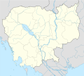
Berkas:Cambodia location map.svg

Konten halaman tidak didukung dalam bahasa lain.
Moroi ba Wikipedia

Berkas si föföna sibai(Berkas SVG, 1.346 x 1.215 piksel, fa'ebua berkas: 594 KB)

Berkas andre moroi Wikimedia Commons ba te te'oguna'ö ba proyek tanö bö'ö. Deskripsi ba nga'örö deskripsi berkas te'oroma'ö tou ba da'a.

Fanutunö
Deutsch: Positionskarte von Kambodscha

Quadratische Plattkarte, N-S-Streckung 105 %. Geographische Begrenzung der Karte:

  • N: 14.8° N
  • S: 9.9° N
  • W: 102.2° O
  • O: 107.9° O
English: Location map of Cambodia

Equirectangular projection, N/S stretching 105 %. Geographic limits of the map:

  • N: 14.8° N
  • S: 9.9° N
  • W: 102.2° E
  • E: 107.9° E
Baŵa 12.02.2009
Kode

own work, using

Sanura NordNordWest
Versi lainnya Derivative works of this file:  Flag map of Cambodia.svg
Kartenwerkstatt
This map has been made or improved in the German Kartenwerkstatt (Map Lab). You can propose maps to improve as well.

Lisensi

Saya, pemilik hak cipta dari karya ini, dengan ini menerbitkan berkas ini di bawah ketentuan berikut:
GNU head Tetehegö wangai, wame'e ma wamulö'ö dokumen andre faoma Lisensi Dokumentasi Bebas GNU, Versi 1.2 ma zui sabölö afuria nifataro Free Software Foundation; lö Seksi Invarian, lö teks uli föna, ba lö teks uli furi. Kopi lisensi no tefaogö ba waosatö sotöi Lisensi Dokumentasi Bebas GNU.
w:id:Creative Commons
atribusi fa'ohe'ö
Tola ölau:
  • fa'ohe'ö – wo-kopi, distribusi ba transmisi mbua halöŵö
  • mamaruka – mamulö'ö ba mamazökhi zibohou moroi ba halöŵö andre
Molo'ö kondisi andre:
  • atribusi – Si lö tola lö'ö ösura kredit, khai-khai silalö ba lisensi ba ombakha'ö na so nifabö'öni. Tola ölau ia molo'ö fangera-ngerau, ba hiza böi sura wa no ifarou ndra'ugö sololohe lisensi.
  • fa'ohe'ö – Na öbulö'ö ba öfazikhi zi bohou moroi ba halöŵö andre, si lö tola lö'ö öbe'e kontribusimö faoma same or compatible license simane lisensi halöŵö asli.
Fili lisensi somasi'ö

Captions

Add a one-line explanation of what this file represents

Items portrayed in this file

menggambarkan Indonesia

status hak cipta Indonesia

berhak cipta Indonesia

tipe media Indonesia

image/svg+xml

checksum Inggris

ce5625269ff26b6a990310800d2e0c9617f06100

metode penentuan Indonesia: SHA-1 Indonesia

ukuran data Indonesia

608.531 Bita

tinggi Indonesia

1.215 piksel

lebar Indonesia

1.346 piksel

Waö-waö berkas

Höndrögö ba mbaŵa/ginötö wamaigi hewisa berkas ba ginötö andrö

Baŵa/InötöKhala-khala berkasSu'a-su'aSangoguna'öKomentar
fondrege bohou14 Januari 2014 02.44Gambara khala-khala versi 14 Januari 2014 02.441.346 × 1.215 (594 KB)NordNordWestupd
13 Februari 2009 04.35Gambara khala-khala versi 13 Februari 2009 04.351.347 × 1.217 (711 KB)NordNordWestsmaller file
13 Februari 2009 03.56Gambara khala-khala versi 13 Februari 2009 03.561.347 × 1.216 (1,03 MB)NordNordWest{{Information |Description= {{de|Positionskarte von Kambodscha}} Quadratische Plattkarte, N-S-Streckung 105 %. Geographische Begrenzung der Karte: * N: 14.8° N * S: 9.9° N * W: 102.2° O * O: 107.9° O {{en|Location map of [[:en:Cambo

Lö nga'örö sangoguna'ö berkas andre

Fangoguna'ö berkas global

Wiki tanö bö'ö sangoguna'ö berkas andre

Faigi more global usage berkas andre.

Metadata